Colorado’s Yampa River retains a distinction not afforded to any other major river in Colorado or the entire Colorado River system stretching southwest to California and Mexico. It is substantially undammed but for a few small to medium-sized reservoirs near its headwaters. In the 250 or so miles it runs from the Flat Tops Wilderness Area southeast of the small town of Yampa, north to Steamboat Springs and west toward Utah, the snowmelt-flooded river courses wildly each spring. Flows taper off by the end of the summer following the natural hydrograph, or charted rise and fall, of the river’s cyclical runoff pattern.
On the southern side of the Flat Tops, another Colorado River tributary collects snowmelt and follows first a southwesterly route, then northwesterly, and then nearly parallels the Yampa heading west. The White River, which flows into the Green River in Utah, has an annual runoff of about 600,000 acre feet. That’s just over one third of what the Yampa provides to the Green on average—1.6 million acre feet—when the two merge in the heart of Dinosaur National Monument at Colorado’s western border.
The region is seemingly awash with plenty of water, so much so that most people who divert it do so without ever invoking Colorado’s prior appropriation system where senior water rights take precedence over junior. Only a few tributaries of the Yampa River—but nowhere on the mainstem downstream of the town of Yampa—have been subject to administration, when the priority system kicks in and water commissioners representing the state have to cut off junior users. During the one summer, 2002, when the river ran really low and a couple of entities could have made a call, water users cooperated to avoid forcing anybody out. Instead, everybody took a little less.
On the White, the story is much the same. Just twice have water commissioners stepped in on the mainstem. It was upstream of the town of Meeker in 1997 and in 2002. The most heavily administered stretch of water in the White River Basin is farther west, on a major tributary of the White called Piceance Creek. Most of the water rights there are held by energy companies, there to extract coal, natural gas, and probably, eventually, oil shale.
This northwestern corner of Colorado has long been a quiet place, home to hardy individuals in search of wild, open spaces they imagined would be impenetrable to the forces of modern society’s advance. It would seem, however, that in the Yampa, White and Green river basins, the 21st century echoes increasingly louder with the march of that advance. Not only is the region beginning to contend with its own increasingly rapid growth rate, but it is also being confronted by other parts of the state that are growing more dramatically. As the Front Range searches for water security, they’ve identified the Yampa River as a potential future spigot.
And the White faces its own uncertainties as energy companies continue, as they have for decades, to shore up water rights that would be necessary for developing the abundant oil shale resource the Piceance Basin happens to be riddled with. Times are a changing. But residents are saying “not so fast.” Change, in the northwest, happens slowly.
First occupied by an ancient Freemont people and later home to the Ute Indians, the region was the last part of Colorado to be settled by white man. First, the mountain men came after beavers and their pelts. Then, in the 1860s, gold lured settlers to Hahn’s Peak north of Steamboat Springs. Ranchers followed, raising sheep and cattle. When the railroad, dubbed Moffat Road, reached Craig in 1913, high-quality coal was mined and shipped out. And finally, natural gas, once the technology for extracting it from deeper layers was developed in the 1930s, created a boom in the White River Basin. Yet the region’s population remained small.
“Have you ever tried to get over there?” asks Willis Carpenter, the last living son of Farrington (Ferry) Carpenter, renowned Yampa River Valley patriarch who homesteaded there in 1909. His question alludes to the roughness of the land, the breakneck passes that must be traversed and the relative inaccessibility rendered by the jutting Continental Divide.
Some of the initial inaccessibility is harder to imagine now that one has vehicles and roads. Yet, the location of the tri-county region encompassed by those three watersheds, the Yampa, the White and the Green, is still remote enough to leave it largely uninhabited relative to the rest of the state. With a 2005 population of just over 42,000, Routt, Moffat and Rio Blanco counties–the portion of which lie in the Yampa, White and Green basins—are home to fewer people than most of the Front Range’s medium-sized towns.
To Willis Carpenter’s eye, the Yampa River Valley looks remarkably the same as when he was growing up there in the 1930s and ‘40s. The same railroad bisects the middle of his family’s ranch, now owned and managed by The Nature Conservancy. But now, the coal isn’t simply shipped out. A huge coal-fired power plant looms over the ranch. The plant is one of two that were constructed in the valley in the 1960s and ‘70s. The other is in Craig. Combined, the plants divert about 1 percent of the Yampa’s average annual flow for cooling.
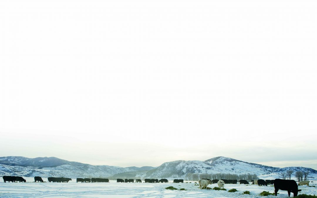
Irrigation is the most significant water use in the region. Though crops like wheat are minimally grown, hay is another story. For thousands of cows and millions of sheep raised by local ranchers, hay nourished by the rivers sustains them for much of the year. In fact, the necessity of feeding the livestock for so many months makes the whole business pretty uneconomical, says Carpenter. “People stick with it because they like the life. They’re not there for the money. There is no greed in their hearts.”
According to a 2007 Census of Agriculture conducted by the Colorado State University Extension Office, total agricultural sales in Routt County, which occupies the upper part of the Yampa River Basin, were $34 million that year. Routt County Extension Director C.J. Mucklow says that the agricultural piece of Routt County’s economic pie has steadily declined to represent less than 1 percent. Tourism has, in turn, grown to account for a much bigger slice. However, the irony of the relationship between the two industries, according to Mucklow, is that the ag lands have a greater value as a tourist draw—$38 million according to a separate 2-year-old CSU study—than they do for the actual products they provide to market.
“Agriculture creates a feel for the community,” says Geoff Blakeslee, who manages Carpenter Ranch for The Nature Conservancy. “It’s something that is attractive; it preserves open space; it’s a reason for people to move here.”
The region is assisted in open space preservation by a vast proportion of public land. The three counties, Routt, Moffat and Rio Blanco, are 49 percent, 69 percent and 75 percent public respectively. Most of it is under the Bureau of Land Management’s jurisdiction, but some is also designated national forest, wilderness, national monument and state park.
The BLM land is used for grazing, as it has always been. In fact, the history of grazing on BLM land is intricately tied to the region. It was the 1934 Taylor Grazing Act, introduced by Edward Taylor, a U.S. Congressman from Colorado’s Western Slope, that created the U.S. Grazing Service, which later became the BLM. The regulatory act was intended to halt overgrazing, which had led to range deterioration and soil erosion. Willis’ father, Ferry Carpenter, was appointed head of the new grazing service and was instrumental in creating grazing districts across the West and in tempering some of the ‘range wars’ resulting from competition between sheep and cattle ranchers.
The Carpenter Ranch water right on the Yampa, dated 1881, is the most senior water right on the river. On the South Platte River, where settlement occurred earlier, that right would be junior to many others. Many water rights on the Yampa and White rivers are not so fortunate. If they have a priority date later than 1922, they are subject to the possibility of a future state-administered curtailment—or stop-use order—on the river related to the 1922 Colorado River Compact.
The “what-if” topic of the lower basin states on the Colorado River suing the upper basin states, including Colorado, for under-delivery at the agreed-upon point of Lee Ferry in Arizona, has been increasingly on statewide and local water planning agendas. In the northwest, under Water Division 6, many major water rights have a priority date post-1922. Says the Division Engineer Erin Light, “So few of the water rights in the Yampa will not be subject to curtailment. It is a definite concern of everybody’s.”
In anticipation of the State Engineer’s eventual rule-making process in which he will determine how Colorado would go about curtailing water use, a prominent water lawyer and board member of the Upper Yampa Water Conservancy District, Tom Sharp, has floated a legal argument that he refers to as the “Yampa Doctrine.”
The argument essentially suggests that under certain provisions of the 1948 Upper Colorado River Basin Compact, which apportions the upper basin’s share of Colorado River water amongst the four states of Wyoming, New Mexico, Utah and Colorado, the Yampa River should not be subject to curtailment as long as it is meeting the compact requirement that it deliver an annual average of 500,000 acre feet, as measured at the Maybell Gage, to the Green River.
Many regional water users are not convinced yet that the Yampa River will be protected under the Yampa Doctrine. But, the community has long been leery that state politics could trump the interests of its small basin. And, as its representatives, the roundtable believes the doctrine’s arguments are substantive and worth debating.
The struggles ahead certainly won’t be the first the region has encountered. And, depending on the point of view, it has prevailed in large controversies in the past, successfully averting the efforts of outsiders in manipulating its prized rivers. In the 1950s, the Sierra Club, led by David Brower, battled for the integrity of the free-flowing Yampa River.
The original plan for the 1956 Colorado River Storage Project included a dam in Echo Park, just below the confluence of the Green and Yampa rivers in the middle of Dinosaur National Monument. Brower argued that if a national monument weren’t safe from development, how could any wildland be kept intact? Brower and his cohorts succeeded in getting Echo Park Dam removed from the plan, but in exchange they dropped their objection to Glen Canyon Dam, which, once constructed, flooded Glen Canyon farther downstream on the Colorado River, creating Lake Powell. Brower later regretted giving up the fight.
Residents of northwestern Colorado, including members of the Yampa/White/Green Basin Roundtable, want to slow down and plan for a future without regret. They are aware that what they have is special.
As modernity catches up, certain changes will be made. Light, for one, is charged with bringing the Water Division 6 community into compliance with state statutes requiring that every water diversion have a measuring device and operable headgate. This is a major shift for the region, one that began in the lower Yampa River below Elkhead Reservoir as a means of protecting reservoir releases intended to reach endangered fish habitat.
Upstream, however, the measuring devices could protect older agricultural water rights from a call by the Colorado Water Conservation Board for a 1977 instream flow decree or from the city of Steamboat for its 2003 recreational in-channel diversion decree. If the senior users don’t get the required devices installed and either entity places a call, Light’s water commissioners will be forced to cut off the senior users and give priority to the junior users, in which case she fully expects to hear cries of ‘bloody murder.’
The population, expected to grow faster here than in any other region in the state over the next 40 years, will also tax regional water planners. Entities like the Upper Yampa Water Conservancy District are already looking for ways to expand storage, says the district’s manager Kevin McBride. And Steamboat Springs, which will likely absorb much of the growth, is preparing to spend more than $30 million to build additional municipal water-related infrastructure.
The future of northwestern Colorado is dotted with unknowns. But the Yampa, White and Green river basins sustain a resilient breed of advocates who are increasingly speaking out with one voice. Whether their message will be heard over the din of time’s relentless march remains to be seen. ?
SIDEBAR: The Yampa/White/Green Basin Roundtable
On alternating months, several dozen committed individuals sit down to discuss water-related concerns relevant to the three river basins of northwestern Colorado. The Yampa, White and Green rivers flow through this remote region of the state, and those at the table are invested in the future of those rivers, not necessarily for the same reasons.
Nine roundtables convened by the 2005 Colorado Water for the 21st Century Act bring diverse interests together to plan for future water supply on a regional basis. Roundtable members include representatives of municipal, industrial, agricultural, environmental and recreational water users as well as each city and county government in the region.
For the past four years, the Yampa/White/Green Basin Roundtable has been conducting water analyses of consumptive and non-consumptive needs. Consumptive needs include uses that divert water from rivers, such as municipal, industrial or agricultural use. Non-consumptive needs, as the name implies, do not consume water. There is no diversion. These include environmental or recreational uses.
All of the roundtables started with data collected through the 2003 Statewide Water Supply Initiative. The Yampa/White/Green Basin Roundtable also requested help from the Colorado Water Conservation Board, the state agency assisting the process, for several progressing studies to specifically assess future water needs for the energy and agricultural sectors. Access more information and a schedule of roundtable meetings at www.cwcb.state.co.us.
 Print
Print