How Colorado can grow water-smart communities
In 2013, elected officials, water providers, planners and other staff from the fast-growing metro Denver communities of Arvada, Aurora, Thornton, Parker and Castle Rock found themselves back in school. During a multi-day land use workshop, taught by Pace University law professors, the local leaders heard about strategies for integrating land use planning and water use, a surprisingly underexplored concept in Colorado. Among the topics covered was how a community could more proactively address water demands and supplies for different segments and end users through its master land use plan.
Consider: Under Colorado law, any town or county with more than 25,000 people must develop a comprehensive or master plan to guide its present and long-term land use. The plan is a roadmap to steer communities through growth and development, and typically includes sections that address housing, transportation, utilities, and, as mandated by state law, recreation and tourism. But water often goes unmentioned or gets short shrift.
“There’s really not that many counties or communities that have a water resources element in their comprehensive plan,” says Drew Beckwith, water policy manager for Western Resource Advocates, who coordinated the land use workshop. “It’s traditionally not been a part of what [counties and communities] thought about.”
As a result, water use, efficiency and conservation have typically been side notes, if not afterthoughts, when it comes to land planning and development. That was fine 50 years ago, says Mary Ann Dickinson, president and CEO of the Chicago-based Alliance for Water Efficiency, but as Colorado and other states have faced rapid growth and water scarcity in recent decades, integrating land use and water planning has become a missed opportunity. Cities and suburbs, mountain towns, and farming communities are now all confronted with providing reliable and clean water for growing populations. And those who are making the connection between land and water planning are devising innovative applications of land use rules—while encountering their share of policy and technical barriers—that reframe how we design, build and manage homes, office buildings, shopping centers, and entire neighborhoods. Noting that some Colorado communities are at the forefront of land use and water supply planning integration, Dickinson says it’s time to “connect the dots.”
Density rules and growth boundaries
Before cities ever considered integrating water management into land planning and zoning, they began tackling a new wave of postwar development. When the City of Boulder’s population skyrocketed from 29,000 to 66,000 during the 1960s, the university town took progressive, early action to address growth and land use. Citizens approved the so-called “Blue Line,” which limited development and the extension of water and, later, sewer services on the city’s outskirts and in surrounding higher-elevation areas. Boulder also pioneered the creation of an open-space tax in 1967, used to purchase natural areas and keep them free from development.
And in the late 1970s, the City of Boulder and Boulder County created an urban service area to guide new urban development in places with appropriate infrastructure, while encouraging rural and less dense development outside those lines. For Boulder, the boundaries created a clear urban-rural edge between city and unincorporated county lands. They also led to the establishment of a 45,000-acre greenbelt that includes open space and some 14,000 acres of land leased to local farmers and ranchers where building permits are limited. Hundreds of other communities have copied the approach, better known as an urban growth boundary. A side benefit of those efforts was minimizing municipal and industrial water demands in areas far from the city center.
Urban growth boundaries for cities and urban growth areas for counties are still implemented in various Colorado communities to direct growth while protecting natural areas, phasing infrastructure investment, and stimulating infill and increased density of development. Don Elliott, a director of Clarion Associates, a national land use consulting firm based in Denver, calls the water savings achieved as a result of these types of policies “a silver lining” to forward-thinking land management.
Zoning, building and land use codes also help direct the type and pace of development in communities, and planners these days often think in terms of “density, diversity and design.” Zoning first defines an area as either residential, commercial, industrial, agricultural or public—such as parks and open space—in order to preserve the character and resources of an area and ensure land uses that can coexist. Traditionally, zoning only allowed a single use and set “maximum” densities, limiting how many houses per neighborhood or the size of buildings or developments per lot. That conventional approach has typically resulted in large lots, which usually mean big lawns that require lots of water, especially in summer when supplies are at their lowest.

Aurora’s Environmental program supervisor Karen Hancock (left) led recent efforts to incorporate more sustainable water quality measures in the city’s land use planning processes. Don Elliott provided consultation to help Hancock bring about a more holistic approach. Photo: Matt Staver
A shift occurred in the 1990s as developers and citizens began to seek out places where they could live but also work and shop and send their children to schools without driving to the other side of town. Mixed-use zoning enables developments to combine single-family homes, multifamily condos, shopping centers and office parks. It also results in more compact growth, enabling more flexible and conservative water use because of the higher densities of people and businesses and the mix of water demands by residential and commercial users.
Today, Boulder, Denver and other cities set “minimum” densities for neighborhoods, apartment buildings and retail centers, which reduces the sizes of lots and lawns and enables more efficient water delivery systems. Urban redevelopment or infill projects, such as Denver’s Stapleton neighborhood at the site of the former airport, are built around mixed-use growth, and they also incorporate shared parks or open space, plus ubiquitous sidewalks for “walkability” or accessible transit between home and shopping. A half-century after zoning laws divided land uses, citizens are increasingly finding mixed-use communities attractive places to live.
The comprehensive view
Elliott, who works with client communities to modernize and improve their regulations and incentives on the land development, housing and sustainability fronts,says minimum density requirements, mixed-use zoning, and open-space designations all provide water savings and allow for more efficient and effective water delivery and other environmental benefits. Natural open space, for example, typically requires minimal, if any, irrigation. But, he adds, water savings haven’t necessarily been driving these policy developments. Cities, including Denver and Aurora, are accommodating smaller lots and more multifamily housing, but it’s driven by the market and affordability concerns, Elliott says. “Let’s be clear: Cities are not pushing for smaller lots to reduce water consumption. They’re pushing for smaller lots because they’re more land-efficient and because the market wants them.”
Elliott and others are promoting more directed planning efforts in terms of water. But that also requires a next wave of planning and zoning tools and applications, as well as a heightened level of cooperation between planners, water resources managers, and city-run or investor-owned utilities.
A city’s zoning, building and density rules typically all fit together under the comprehensive land use plan, which establishes a near- and long-term vision for growth, with appropriate land uses often determined by a city staff of planners with guidance and direction from elected city officials and citizens. While Colorado municipalities aren’t required to specifically tackle water use within this document, some are recognizing the opportunity.
Westminster, on the northwestern edge of metro Denver, has an advantage when it comes to containing growth on its fringes. The city of 106,000 people is landlocked, surrounded by other towns on three sides and the Rocky Flats National Wildlife Refuge to the west. That means there’s a discreet area that planners can focus on when considering future development—and land use and water demands. Westminster’s home-rule status also means it can operate outside certain state statutes that constrain other cities’ authority to implement policies and plans.
Staff in Westminster, including officials at the city-run utilities, have made an effort to cooperate and communicate to better consider the water management impacts of land use since at least 2001, when water resources analyst Stu Feinglas came on board. While its comprehensive master plan sets the rules for types and densities of development, Westminster also has a comprehensive water supply plan that evaluates water needs across the city. City staff use both documents to connect water use projections with development decisions using GIS software and other analytical tools.
“As we developed the recent land use plan, we looked at impacts and came up with a balanced plan for the water that we have and the development we want to have for the city,” says Feinglas. “For instance, we can say we’ve allocated 10 acre-feet for this property, and so if you [want to] build at a density where you need 20 acre-feet, we go into a discussion: Where are you going to get that water from, and is it worth it to put that density in?”
“It gives us the ability to make rational decisions about how we’re using our limited water resources,” adds Grant Penland, Westminster’s principal planner. If a developer requests a certain land use, such as a high-density, high water-use, multifamily-unit subdivision, the city staff is able to know whether that fits within or exceeds available water supplies for that area. If there’s a projected shortage, the developer must make up the difference.
Several other communities across the state are similarly tying planning documents and regulations to water demand. In Colorado’s southwestern corner, the City of Durango compared growth projections and land use patterns outlined in its comprehensive plan with its water supply portfolio and determined it could support 40,000 residents and still grow to be the community it envisions itself to be. Today, including primarily in-town residents as well as some in outlying areas, the city water utility services roughly half that. Having the big picture in mind helps when it comes time to assess applications for re-zoning or other changes to the town’s future land use map, says Durango planning director Greg Hoch.
And in central Colorado, protections for the Fraser River, which runs through the ski town of Winter Park and loses substantial flows to transbasin diversions that supply Denver, have led to a slightly different approach. There mandatory regulations limit development permits in order to avoid dewatering any stretch of the river.
The Grand County Water and Sanitation District, which services the town of Winter Park, was asked to determine the river’s carrying capacity given targeted flow requirements. “We hired Leonard Rice Engineers to give us a number,” says Bruce Hutchins, the district manager. “They said we could serve 9,300 single-family equivalents, but during drought, at three-quarters build-out we would be drying up the river in stretches. The town didn’t like that.”
Instead, 8,300 single-family equivalents was determined to be the maximum supportable development that would still leave 60 cubic feet per second in the river at the confluence of the Fraser and Vasquez Creek, and the city council passed an ordinance making the growth barrier official. Today, the town is at 2,700 single-family equivalents. And growth outside Hutchins’ district’s boundaries, which centers around the ski area itself and is served by the Winter Park Water and Sanitation District, is limited due to protections on bordering federal land.
Tapping new solutions
Landscaping rules, ordinances and incentives are also better integrating water efficiency in land use planning and can show up in comprehensive plans, subdivision regulations, and site plans. Turf limits and xeriscaping rules have become increasingly common in Colorado, limiting the portion of a property that can be occupied by a lawn, or defining permitted grasses and plants that require less irrigation, often through what’s known as a model landscape ordinance.
In the Roaring Fork Valley, which stretches from Aspen to Glenwood Springs, regional water provider Ruedi Water and Power Authority and local governments released a draft Regional Water Efficiency Plan in spring 2015, which includes a model landscape ordinance to help address water use amid steady change in land use and growth in the valley. While the format is still being developed, Mark Fuller, director of Ruedi Water and Power, says the model ordinance will be a set of standards with a checklist of options encouraging the use of native drought-tolerant vegetation, limiting turf coverage and types for parcels, and establishing landscape water budgets. According to the draft plan, the initiative could cost up to $10,000 to launch, but lead to annual water savings of 80 to 100 acre-feet per year by 2050. A water-efficient landscape certification program would rate efforts among categories such as businesses, schools or homes, providing further incentive to achieve water savings.
“The idea is to try to bring some consistency to how landscaping is installed and maintained in the valley,” Fuller says. The efficiency report and the ordinance steer away from regulatory directives or mandates and instead focus on education, outreach and voluntary programs to boost efficiency and conservation. Whether that approach can reap meaningful conservation savings without also implementing statutory rules remains to be seen.
To avoid implementing all-out restrictions, many communities are trying to achieve results through financial incentives. Aurora Water, for example, is testing the effectiveness of new fee structure, adopted in 2014, that rewards developers who elect to put in water-saving landscaping. For developers in Aurora, the savings are especially substantial for outdoor irrigation meters, which typically service commercial and residential common areas, and for which connection fees are tiered under the new system. The outdoor use portion of the fee, calculated on a square-footage basis, is slashed in half when xeric landscaping is installed instead of bluegrass. If a developer goes a step further, installing what the utility calls “z-zone” landscaping that will require no additional irrigation after an initial three-year establishment period, the fee can be refunded entirely after those three years. For every 10,000 square feet of landscaped area, the savings reaped could tally up to $27,500 for developers implementing the z-zone option. Within the first few months after adoption, the incentive compelled five out of six developers to pursue the z-zone, resulting in 730,000 square feet of landscaped ground that will not require a permanent water supply.
Most of these types of efforts and ordinances are targeting new developments with the intent of establishing water-conscious lifestyles before people ever move into their homes. For existing buildings, cities instead provide incentives and rebates—for instance, to remove turf and replace with xeriscaping or to install water sensors that can override sprinklers if the ground is already sufficiently moist.
While promising, landscaping rules are vulnerable to enforcement issues, Elliott says, since they require a utility or local government to monitor practices and ensure compliance on the back end, which can be expensive and intrusive. One way to help close the door is to implement a water budget rate structure tied to the actual needs of a landscape, where customers who use more than what is budgeted are charged premium rates. Communities in Colorado that have gone this route include Boulder, Castle Rock and Centennial. Despite the gaps in enforcement and mandates or relatively modest rate hikes, the progress is noteworthy. “Ten or 20 years ago, you would have found very few development codes that said anything about how to lay out a subdivision with turf,” says Elliott. “Now there are many that do.”
Aurora is also forging ahead with water-conscious planning by developing a low-impact development draft ordinance, believed to be among the first in Colorado.
The measure will encourage more environmentally sensitive stormwater management in residential subdivisions, says Karen Hancock, City of Aurora environmental program supervisor. That means using and creating “bio-retention” features, such as natural swales and permeable pavement blocks, instead of building conventional, often cemented detention ponds to collect and pipe stormwater. The green elements allow stormwater to filter back into the ground and aquifers, instead of running off hard surfaces to sewers and picking up pollutants along the way. The effort got in motion after Hancock attended the Land Use Leadership Alliance workshop, and Aurora received a $25,000 technical-assistance grant that enabled staff to work with Don Elliott to develop the ordinance.
Staff hopes to show it can not only improve stormwater management but also save space by eliminating the need for a supersized detention pond. That could then give a developer another lot to build an additional home, a benefit that should lead to buy-in, Hancock says, and hopefully change business-as-usual practices.
As the state’s third-largest city, with half of its 154 square miles still undeveloped, Hancock says, “We need to be thinking about this. Denver is more of a redevelopment thing; for us, it’s all greenfields, so it’s pretty critical we get this right.”
Tomorrow’s homes on the range
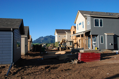
With a 62.4 percent growth rate between 2000 and 2010, Douglas County, which includes Castle Rock, Parker, Castle Pines and Lone Tree, has been the state’s fastest-growing county so far this century. Developers built more than 2,000 new housing units in 2014 alone, and the county now has more than 308,000 people. While the population has swelled with retirees and commuter families, its water use has depleted the Denver Basin groundwater aquifer system, a finite resource.
That predicament compelled Douglas County officials to examine regional water use and supply, including the land use connections that can reduce demands. The county was among the first governments to tackle water use within its comprehensive land use plan. To reduce pressures on the Denver Basin, starting in 1998 the county created a water supply overlay district covering its western half. The overlay zone provides another level of zoning with added restrictions on groundwater use.
“We want to make sure the water supply that any new developer brings to the table within those areas has a long-term viability component that can stand the test of time,” says Tim Murrell, Douglas County water resources planner.
The creation of an overlay district tied to available water supply is an example of a community using existing land use tools to integrate water supply planning. Typical planning has worked on a broad scale, using community-wide population projections and current per-capita water use to set future water needs, says the Alliance for Water Efficiency’s Dickinson. But that approach doesn’t account for different growth and water availability trends within communities, Dickinson says, and it ignores water efficiency improvements that allow homes and neighborhoods to do more with less water. Douglas County has put itself at the forefront of 21st-century land use and water supply integration, and developers are beginning to tune in to the resulting opportunities.
This fall, development will begin at a new community within the overlay zone: Sterling Ranch will include shopping areas, office space, and up to 12,000 homes over a 20-year build-out, rivaling nearby Highlands Ranch in size. But the new growth will also serve as the “poster child,” Murrell says, for water-efficient development. Houses and lots will use just 0.25 acre-feet per year, one-third of the water approved for typical family properties under Douglas County standards. Homes will exclusively have WaterSense fixtures—the U.S. Environmental Protection Agency-sanctioned water equivalent of the Energy Star program—and xeriscaped yards with small turf areas, targeting 70 percent less irrigation than conventional neighborhoods. The community will encompass large tracts of open space, use hyper-efficient irrigation systems, and is piloting the state’s first rainwater-harvesting system for outdoor watering. The first phase will include 800 homes, a school, a church, a recreation center, and 85 acres of open space.
“They are a great example of a development within the water-constrained part of [Douglas] County that fully embraced that reality and really worked hard to lower that overall demand standard,” Murrell says.
“Sterling Ranch is showing it can be done,” adds Paul Lander, landscape sustainability instructor at the University of Colorado, Boulder, and water conservation expert. “It really raises the bar, not just in Colorado, but across the Southwest.”
Dickinson’s organization is leading an effort to make developments like Sterling Ranch the rule, rather than the exception. Through the Net Blue Initiative, the Alliance for Water Efficiency and its partners are developing a national template ordinance that a community can adopt for water-scarce areas to require a developer to offset water use before the development could be approved. Working through planning and zoning tools, the land use rule could be an overlay district, such as that of Douglas County, and would help prevent communities from reaching critical water shortages while also ensuring that developers, planners, architects and water providers are considering water use along with land planning and community design.
Examples from outside Colorado offer insight into other tools and initiatives that the state and its communities may eventually tap. The small town of Cambria, California, implemented an offset ordinance in the 1990s when a 666-home community was put on hold because of drought and an insufficient water supply. That ordinance requires developers to pay to retrofit existing homes with efficiency and conservation measures—from irrigation water sensors to high-efficiency fixtures—and thereby create a water supply for the new homes being built.
Arizona, meanwhile, requires communities’ comprehensive plans to specifically address water use and planning, a step conservation proponents would like to see taken in Colorado. And Arizona, along with New Mexico, Utah and California, is among the select group of western states that also permit residential rainwater collection to enable neighborhoods to reduce irrigation needs. Although Colorado has allowed for limited experimental rainwater harvesting pilot projects, the practice is otherwise prohibited due to its potential to interfere with others’ water rights by intercepting stormwater runoff that feeds rivers. Either step—requiring water’s consideration in comprehensive planning or allowing rainwater harvesting—would require legislation from the state General Assembly, and while a bill that would have permitted rainwater collection using the equivalent of two 55-gallon rain barrels passed the Colorado House of Representatives in the 2015 legislative session, it was later killed in the Senate.
The Net Blue Initiative will incorporate several of these approaches and other innovative tools, such as graywater and even blackwater treatment and reuse systems, to calculate offsets and craft the template ordinance, which it plans to complete by the end of 2016.
A similar, local effort, the Net Zero Water Initiative, is in the works through the Colorado Water Innovation Cluster, says Becky Fedak, an engineer with Brendle Group, who is developing the program’s planning toolkit. The effort will test how to achieve net-zero water use at various scales, from small businesses to water-intensive industries to city neighborhoods, working with the City of Fort Collins, Adams County, and New Belgium Brewing Company. The spreadsheet-based toolkit will help guide entities to identify appropriate strategies and goals to reduce water usage and improve water quality and stormwater management, and should be released publicly within the next year, Fedak says.
Certification programs could also help guide efforts for improved water and land planning integration. The Home Energy Rating System (HERS) is a national index that scores homes based on their energy performance. Following that model, the Residential Energy Services Network and partners are developing the Water Efficiency Rating (WER) Index to provide a quick overview of a home’s water use and efficiency to homebuyers and owners, as well as builders, developers and real estate agents. Frank Kinder, Colorado Springs Utilities conservation specialist, and other state water managers helped craft the water efficiency index, which will be available at the end of 2015. “Colorado has been an early adopter,” Kinder says, when it comes to adopting water-efficient new home construction and certification. He cites many Colorado cities’ and utilities’ use of efficiency rebates, their participation in WaterSense (the U.S. Environmental Protection Agency’s efficiency program), and a 2010 legislative bill that requires builders of single-family homes to provide a “water-smart” option with certified efficient fixtures to new homeowners.
The WER Index would also complement an extension of the U.S. Green Building Council’s popular Leadership in Energy and Environmental Design program, known as LEED. The LEED extension evaluates environmental performance on a neighborhood-wide scale rather than just building by building. Water conservation and efficiency measures—such as reduced impervious surfaces that cause excessive stormwater runoff, mandated xeriscaping, and the installation of efficient WaterSense household fixtures—are among the steps that can earn points for a neighborhood’s certification.
Drops in the bucket

Pace University’s Tiffany Zezula led the 2013 Land Use Leadership Alliance workshop that Western Resource Advocates organized for Colorado leaders and land and water professionals. Zezula works nationally and says Colorado is ahead of the curve in connecting the two resource issues. Photos: Western Resource Advocates
Patti Mason, executive director of the Green Building Council’s Colorado chapter, says developers have shown interest in the neighborhood credentials. Stapleton’s developers, for example, used the program initially to lay out the community’s master plan, although they didn’t complete the formal application process. “It’s new and it’s a little more niche and custom, for now,” Mason says. She is also helping to develop a “green features” addendum for Colorado real estate’s multiple listing service, or MLS, to highlight homes that include energy- and water-efficient amenities. In cities such as Portland, Oregon, and Seattle, Washington, “green” homes now draw higher sale prices.
In May 2015, a next class of communities took part in the Western Resource Advocates-sponsored land use workshop. Two years after the first course, several of the initial participants have taken strides to craft land use rules and codes that are building on the workshop’s lessons.
“I think they’re getting it, and there has been great progress,” Beckwith says of the participating cities. “If you’re not discussing water in planning, it’s unlikely you’re going to make progress.”
Of course, water constraints and costs are urging along action, whether towns and officials are engaged or not. Innovative tools that support the nexus of water management and land use make both environmental and financial sense, adds Lander, especially as water prices creep higher and supplies get scarcer. Each local success story shows other communities that the process and tools aren’t “so scary.” Policy challenges, from passing binding local and state laws to implementation and enforcement, certainly pose barriers, but progress is clearly being made and elected officials, developers, planners and water providers are all increasingly recognizing the benefits.
One final element will help determine the pace and success of the push to integrate land use and water management: support and engagement from the people who live here. Lander points to Sterling Ranch and says the development’s inclusion of progressive water and land planning from the get-go, with its smaller lots and even smaller lawns, will ultimately test how and if an ingrained community conservation ethic develops among residents. Says Lander, “We’re really banking that values have changed.”
 Print
Print