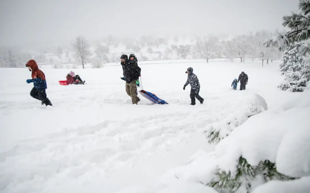
All major river basins in Colorado are at or above their normal snowpack for this time of year thanks in part to recent storms that dumped 2 to 5 feet of snow on parts of the state.
This winter got off to a slow start, but as of Monday, the state’s snowpack is above average at 109% of the historic norm. The accumulation of snow in the mountains provides a vital source of water for Colorado and other Western states as it melts. The recent storms also covered this season’s dust-on-snow events, which can hasten that snowmelt and leave water users and rivers in short supply in late summer.
“As far as snowfall: Really healthy totals, especially everywhere essentially east of the [Continental] Divide and into the I-25 corridor,” said Bruno Rodriguez, a meteorologist at the National Weather Service station in Boulder.

The storms dumped 2 feet to 4 feet — in some cases 5 feet — on the Front Range foothills. In the Denver metro area, snowfall varied significantly. Denver International Airport saw almost 6 inches and canceled more than 800 flights.
In areas west of Denver, such as Boulder, Golden and Morrison, the snow reached 20 inches to 25 inches, Rodriguez said. Eldora Mountain Ski Resort, west of Boulder, counted 4 feet of snow, so much that it closed Thursday and most of Friday.
The snow piles turned into overflowing gutters as snow melted over the weekend. The snowfall between March 13 and 18 equaled about 2.4 inches of water in the South Platte River basin, according to the Natural Resources Conservation Service. The basin had 114% of its median snowpack as of Monday, and it was at 92% of the typical peak snow accumulation.
The storm system, which started in earnest Thursday and continued into the weekend, was the heaviest snow for most areas since a mid-March blizzard in 2021, Rodriguez said.
“East of the divide, it was … significantly more impactful and significantly more snowfall than any of the previous storms this season,” he said.

Another significant storm system carrying moisture from the Pacific Ocean swept up from Arizona into southwestern Colorado last week.
About 3 inches to 8 inches of snow fell across most of western Colorado’s mountains between March 12 and 14, according to Matthew Aleksa, a National Weather Service meteorologist in Grand Junction.
The San Juan mountain range received the most with an average of about 1 feet to 2 feet. Some areas saw 3 feet to 4 feet of snow accumulation. Red Mountain Pass ended up with 26.5 inches of snow, and Coal Bank Pass had 30 inches.
The San Miguel-Dolores-Animas-San Juan combined basin, which includes the San Juan mountains, was 103% of its historical median as of Monday. Other Western Slope river basins were between 103% and 113% of their 30-year medians. The Colorado Headwaters basin, which covers Rocky Mountain National Park down to the Grand Junction area, was at 107% of the median snowpack for this time of year.
Colorado has less than a month left before April 7, when snow accumulation typically peaks before snowmelt begins. Although Colorado is above average for this point of the year, it still needs more snow to match the historic snowpack levels at its seasonal peak.
“We’re definitely trending positively overall,” Rodriguez said. “We can conceivably dry out from here out until April, May. But it doesn’t really look, at least in the short term in the next few weeks, like we’re going to be completely dry … so I would expect that positive trend to continue and hold strong through the next month.”
The recent snowfall also helped cover what can best be described as the season’s first “major dust wallop,” according to Jeff Derry, executive director of the Center for Snow and Avalanche Studies.


FROM LEFT: A significant dust layer shows in the snowpack March 11, 2024 on McClure Pass. (Center for Snow and Avalanche Studies, contributed) The Center for Snow and Avalanche Studies Executive Director Jeff Derry visits a weather station with a deep snowpack near Red Mountain Pass, Apr. 13, 2023, outside Silverton. (Hugh Carey, The Colorado Sun)
 Print
Print