After trekking on skis up a mountain, two men unpack equipment, use a long metal tube to take a snow sample, weigh it, and record the measurement. Captured on 16mm film in the mid-twentieth century, the men demonstrate the most advanced snow survey techniques of their time, providing us a fascinating glimpse into the past.
Three such films—one of which is undated, with the others being from about 1941 and 1952 (narrated and in color!)—held by the Colorado State University Water Resources Archive, when considered with related photographs, reports, data, and letters, reveal an important part of the story of the development of snow surveying and water supply forecasting in the western United States.
Federal coordination of snow surveying began in the 1930s, after several decades of individual states and institutions independently taking measurements. Though Nevada and Utah are recognized as the pioneering states, in 1902 Colorado’s state engineer hired Enos Mills as the state’s first snow surveyor. Several of his 1903 and 1904 letters in CSU’s Agricultural and Natural Resources Archive provide insight into how monitoring snowpack started here.

Two men measuring snow, undated. From the Irrigation Research Papers, Water Resources Archive, Colorado State University Libraries. https://hdl.handle.net/10217/178534
By the mid-1930s, following the drought of the early part of the decade, interest grew in having water supply predictions. The U.S. Department of Agriculture took on snow surveying and water forecasting not only to benefit irrigators who relied on the forthcoming snowmelt, but also to support the economic interests of industry and hydropower as well as predict stream flooding.
In Colorado, Ralph Parshall, as senior irrigation engineer at the USDA branch in Fort Collins (and best known for the Parshall flume), contributed to the emerging Federal-State Cooperative Snow Surveys in a number of ways. Parshall’s materials in both his archival collection and his team’s files document his active participation over more than a decade. These include letters and drafts related to several Colorado River Water Forecast Committee meetings, including the first, held in 1945 and at which Parshall presided. A published draft of those proceedings can be found in the Water Resources Archive’s Groundwater Data Collection.

Trail Ridge Road, Ralph Parshall and Park Ranger Jones, May 1941. From the Groundwater Data Collection, Water Resources Archive, Colorado State University Libraries. https://hdl.handle.net/10217/23340
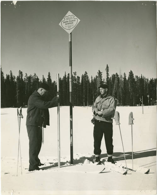
Also among Parshall’s materials, a few dozen photographs of snow courses and related images also exist, some of which remain to be digitized. Additional photographic materials in other collections include slides showing Parshall and others conducting snow surveys at Cameron Pass and in Rocky Mountain National Park, as well as a set of about 100 images (not digitized) taken during winter and spring months at McNey Hill in northern Colorado. This set reveals a decade-long photography project involving both Ralph Parshall and his son Max.
A collection from the Colorado Snow Survey Program of the Natural Resources Conservation Service contains two boxes of photographic materials. These images show snow survey sites and equipment, agency employees, and public outreach events. Two of the films referenced above also are in this collection. The NRCS, having evolved from the USDA division that Ralph Parshall was part of, began operating the first SNOTEL (SNOpack TELemetry) site in 1977. This automated system of collecting snow and weather data greatly furthered the field, especially for remote sites where access is difficult.
The science, methods, and equipment related to measuring snowpack and estimating water content have continued to evolve. In the Water Resources Archive, documentation of snow hydrology studies as well as aerial snowpack measurement is also available for research.
Additional collections in the Water Resources Archive also touch in part on snow surveying and can be found through browsing our research guide. All of our materials are available for use by the public, and assistance can be provided in person at CSU’s Morgan Library or remotely.

Patricia Rettig, Associate Professor, Libraries, Colorado State University, March 29, 2022
Patty Rettig is the archivist for the Water Resources Archive at the Colorado State University Libraries. Over more than 20 years, Rettig has built the archive to hold over 130 distinct collections documenting Colorado’s water heritage by engaging with the water community across the state. She is happy to help anyone dive in to archival research!
Read more about more about snow in the Spring 2024 issue of Headwaters magazine: “The Snow Issue.”
 Print
Print