In a system where timing is everything, reservoir operators and water managers work behind the scenes to tweak flows for fish
Those who manage the Colorado River sometimes refer to it simply as the Phone Call. Weekly from late June through October, it lasts an hour, maybe two during perplexing weeks. Fifteen to 20 people, sometimes even 30, participate, reporting plans and voicing needs in an effort to create semi-natural flows in a river system that is anything but natural. Their most basic aim is to recover four species of endangered fish native to the Colorado River Basin that, according to the accounts of early settlers, were nobody’s first choice for a meal. Too many bones!
Meeting target habitat flows set by the U.S. Fish and Wildlife Service for a critical river segment called the 15-Mile Reach, which is directly upstream of Grand Junction, is the essential purpose of the Phone Call, although, since its inception in 1995, the agenda has broadened to other matters.
Today, the Phone Call illustrates the pervasiveness of management in river flows. Here and there, creeks look much as they might have 150 years ago. But in the larger aggregation, little is left to chance. Big dams provide the means to regulate flows, and Colorado’s first-in-time, first-in-right doctrine of prior appropriation furnishes the legal structure for water’s administration.
But the law alone explains only so much. Despite the well-worn but rarely documented stories of bludgeonings by irrigation shovels, colorfully captured in the adage about whiskey being for drinking and water for fighting, there has always been a strong element of neighborly cooperation that serves as a caulking between the letter of the law. The Phone Call continues and expands this same spirit of cooperation. It’s not entirely a voluntary cooperation. The fish silently command all ears to the telephone. But it is cooperation, whatever the motivation, that is less forced and more genial than it used to be.
“I was just floored,” says Eagle-based consultant Caroline Bradford, remembering her reaction after first listening to one of the weekly conversations. Here, she realized, the decisions were being made about how much water would flow in every tributary and the mainstem itself. “They don’t just do it once, but every week. If the flow in your river goes up or down, it’s likely because the people in this group decided it.”
The Phone Call is launched from an ordinary office building in Glenwood Springs. The building houses Water Division 5 of the State Engineer’s Office, which has responsibility for the bookkeeping and administration of water along the Colorado River’s mainstem and all its tributaries within Colorado except for the Gunnison River. It’s a tall task, more challenging yet as incremental demands are imposed on the river outside the traditional bounds of state water law.

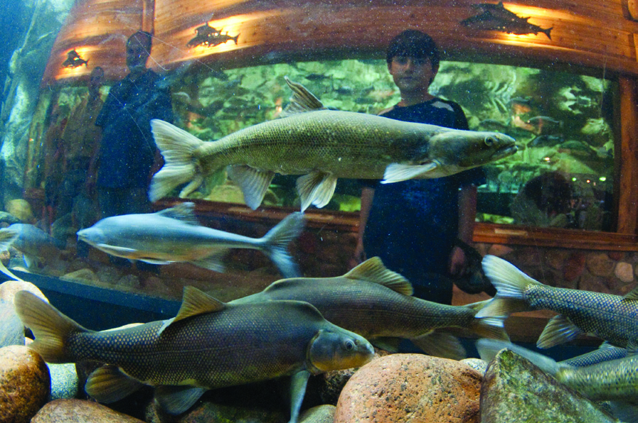
The 154,000 acre-foot Green Mountain Reservoir stores water on its way down the Blue River to the Colorado. In 2010, nearly 58,000 acre feet of water released from Green Mountain was purposefully timed to benefit endangered fish. Photo By: Jeff Dahlstrom, NCWCD
By Colorado standards, the Colorado mainstem is a big river, the native flows in the basin constituting 32 percent of the state’s surface water. Fifteen percent of those flows are forced to reverse direction, however, directed eastward through canals, tunnels and pipes in order to irrigate farms as far away as the Nebraska and Kansas borders, but especially to nourish the urban corridor from Pueblo to Fort Collins.
Colorado River water that does continue downstream, if not detained by one of many dams, has a long journey. It takes three days for water to flow from its headwaters in Rocky Mountain National Park to the Colorado-Utah state line. Driving would be faster—five hours—unless you shadow the river on gravel roads as it wiggles through its canyons. To explore its tributaries—the Fraser, Williams Fork, Blue, Eagle and Roaring Fork rivers being just the start of the list—could take weeks, or maybe a lifetime.
A registry of who’s on the line starts the Phone Call each week. Voices sound off from offices in Loveland and Denver, Boulder and Lakewood, Berthoud and Colorado Springs, plus many locations within the basin itself. A hydrologist in Salt Lake City reports modeled flows based on temperature and precipitation forecasts, and a meteorologist from Grand Junction issues a 10-day weather forecast. If it’s going to rain on the alfalfa farms and orchards, less water needs to be released from reservoirs in the headwaters.

Boating down Gore Canyon’s steep chasm (above) is not for the faint of heart. Photo By: Peter McBride
Water managers live by numbers. Weekly they listen to readings of gauges on the river at Kremmling, Dotsero and other locations. Next come reports from reservoir operators. A representative from Denver Water, talking from the agency’s headquarters along Interstate 25, Invesco Field in the distance, might report levels at the Williams Fork Reservoir, which sits just south of Parshall. From Loveland, a U.S. Bureau of Reclamation representative gives status reports for reservoirs that are part of the Colorado-Big Thompson project: Green Mountain, Granby and Shadow Mountain, plus Willow Creek and Windy Gap.
These reservoirs near Granby, combined with Denver’s diversions from the Fraser and Williams Fork valleys through the Moffat Tunnel, remove 60 percent of the Colorado River’s flows near its headwaters before it has a chance to fully flex any muscle. The river segment from Granby to Kremmling was long ago declared a Gold Medal trout fishery by the Colorado Division of Wildlife, and in some years it still can be. But in 2006, for many reasons that unwelcomingly aligned, the river was reduced to little more than wet rocks. The Northern Colorado Water Conservancy District, which operates the Colorado Big-Thompson Project in conjunction with the U.S. Bureau of Reclamation, is required to release just 20 cfs from Granby Reservoir, and that’s about all that was in the river for the 28 miles between Windy Gap and Kremmling, where it is fortified by the Blue River and Muddy Creek. Pumps used by ranchers to irrigate their hay fields were left high and dry. Moss created in the low water and high temperatures was everywhere—and it stank.
Anglers went home, and county officials went to work. Grand County that year secured water, now up to 3,500 acre feet annually, from surpluses at Windy Gap Reservoir. For $75,000 each year in electricity, the water is pumped back up to Granby Reservoir for storage until late summer, when it is released. This dribble can double the river’s flow, giving brown trout a place, as W.C. Fields said, “to do it.” Taxpayers have told county commissioners that the pumping costs are money well spent, says Lurline Underbrink-Curran, county manager. And now, at least in late summer, Grand County’s status has routinely become part of the Phone Call.
Rights to River Water
The broader brushes of the Colorado River Basin are painted boldly by large transmountain diversions, as well as other major water rights and sizeable dams. More than a dozen ditches, tunnels and other devices defy the central definition of the Continental Divide in parting the ways between those of the Atlantic and Pacific oceans. From the perspective of many who live on the Western Slope, this all amounts to moral grand larceny, whatever else the Colorado Constitution may say about the right to appropriate water never being denied.
Regardless of end use, dams are indispensable to the Phone Call’s goal of ensuring sufficient flows reach the endangered fish in the Grand Valley while protecting other water uses. Five of the six largest reservoirs—Granby, Williams Fork and Wolford, plus Dillon and Green Mountain—are clustered in the broad basin upstream from Gore Canyon, the region most heavily tapped for diversions to the Eastern Slope. The sixth, Ruedi, is near Basalt.

While working on Colorado River: Flowing Through Conflict with photographer Peter McBride, author Jonathan Waterman hangs onto his guide, who attempts to free their boat (below). The canyon is run only at specific water levels where boaters can safely navigate dangerous, jagged rocks like these, remnants of railroad bed construction. Photo By: Peter McBride
The federal government has a powerful hand on the levers of this plumbing. The U.S. Fish and Wildlife Service oversees interests of the fish, having say-so in how much water must be delivered downstream. It does so steadily, if with some restraint. The U.S. Bureau of Reclamation owns and manages two key dams. Ruedi Reservoir was built to serve the needs of Western Slope residents as mitigation for transbasin diversions through the federally-financed Fryingpan-Arkansas Project. Green Mountain Reservoir, which is older and larger, similarly was built to accommodate Western Slope parties in compensation for the Colorado-Big Thompson Project.
Green Mountain Reservoir last year contributed 59 percent of the 97,575 acre feet released from reservoirs either directly or indirectly to benefit the fish at Grand Junction, while Ruedi Reservoir delivered another 21 percent. The balance came from Wolford Mountain, Williams Fork and Granby reservoirs.
Because of this strong federal presence, Ron Thomasson, calling in from the U.S. Bureau of Reclamation office in Loveland, moderates the Phone Call. He is politely but firmly insistent on forging consensus about how to get water to the fish. “There were some difficulties in the early years,” he says, “but a significant level of trust has been built up, creating a highly functional group that I think manages the river pretty darned well.”
Colorado’s first-in-time, first-in-right doctrine of prior appropriation still provides the basic bones for administration. By that system, the oldest water right in the Colorado River Basin was in French Gulch, near Breckenridge, dated 1860—for gold-mining purposes, although now abandoned. Now the oldest water right is on Maryland Creek, north of Silverthorne, a decree for 5 cubic feet per second for meadow irrigation. It has a seniority of July 1, 1869. Not that it matters all that much. There aren’t any upstream users on Maryland Creek. In fact, it’s a measure of how water-rich the Blue River Valley is that no full-time water commissioner was assigned there until 1990.
The single most important water right in understanding management of the Colorado River, however, is far from the oldest. It belongs to the Shoshone hydroelectric plant in Glenwood Canyon. Driving through the canyon since the completion of Interstate 70, it’s easy to miss the pumpkin pie-colored buildings now located below road grade. Water people don’t. They understand the influence of the water rights there, which affect the distribution of water both east to Denver and west to Fruita. Owned by Xcel Energy, Shoshone’s 1902 water right is for 1,250 cubic feet per second, enough to suck the river nearly dry for about three miles during the winter, making a substantial dent even in summer.
When Shoshone is running, it creates certainty for river users. Those with upstream water rights more recent than 1902—which includes most transmountain and other diversions of any size—cannot remove or hold back water from the river if Shoshone has not received its full share. For downstream users, regardless of seniority, the water that returns to the river after being used to produce electricity is guaranteed to be coming their way.
Any interruption of Shoshone’s call for water is an upset of the apple cart. It is so unsettling to all users that they have at times agreed to a protocol that assumes the Shoshone call is “on” even if the plant experiences an outage.

Shoshone hydropower plant has the most senior, large-volume water right on the Colorado mainstem. The bonus for other users is that the water returns to the river after producing electricity. Photo By: Kevin Moloney
Cooperating to Sustain Adequate Flows
The crux of the weekly conversation is about flows farther downstream and the effect upon endangered fish. Three major ditches withdraw water from the lower Colorado River upstream of the critical 15-Mile Reach for the fish. Often these diversions are collectively referred to as the Cameo call, after a former coal mining community located nearby. Together, they draw about 80 percent of the river’s flow there to irrigate 70,000 acres of peaches, pears and corn, but also alfalfa, winter wheat and exurban lawns, and in recent years, vineyards. Representatives of the irrigators, working out of Palisade and the Grand Junction area, are wont to remind those on the Phone Call that it’s hot and dry in their valley.
The Grand Valley water infrastructure begins in DeBeque Canyon, 23 miles northeast of Grand Junction. There, the picturesque roller dam, marked by sentinels with fire truck-red tiles, raises the water level, prodding water into the Government Highline Canal. This large ditch, part of the Grand Valley Project, was created in a partnership between Reclamation and a local nonprofit now called the Grand Valley Water Users Association. It began delivering water to farms in 1917 and now creates greenery to within five miles of the Utah border, 55 miles away. Before the river flushes out of the canyon, a portion of water from the Government Highline Canal is diverted to a pipeline that burrows under the Colorado River and Interstate 70, delivering water to another canal on the opposite canyon wall. From the highway, it looks like a retaining wall. It carries the water used to irrigate the orchards and vineyards of Orchard Mesa. In Palisade, the Grand Valley Irrigation Company headgate draws more water, as it has since 1884, for distribution to Grand Junction and beyond.
Like Shoshone, the Cameo water rights are for large volumes and with seniority, the oldest dating to 1884 and another with a priority date of 1914. Altogether, these ditches draw up to 2,260 cfs from the Colorado River. At times, such as in late September, that’s enough to completely drain the river, which is at the heart of this need for steady, intense oversight.
If it weren’t for cooperative management, the federal Endangered Species Act, passed in 1973, would have sweeping consequences for the Colorado River. This powerful but indelicate tool would have been triggered each time a federal action, for everything from a permit to an annual operating plan, was needed for a new or existing water project on the river or its tributaries, potentially resulting in the reallocation of water to provide flows for endangered fish. Under an agreement struck in 1988, however, the Upper Colorado River Endangered Fish Recovery Program provides an umbrella of mitigation for water projects’ impacts on the fish, in part by obtaining flows through cooperative agreements. So far, 443 water projects in the mainstem basin have benefitted from the program.
The quid pro quo is that the fish get the water they need. Part of this is the result of greater efficiency wrung from the delivery of irrigation waters in the Grand Valley. Before, some unused water from the 150 miles of canals there returned to the Colorado River—but below the critical 15-Mile Reach—in what is called an “administrative spill.” Through both physical improvements financed by the recovery program and more savvy management, the Grand Valley Project reduced diversions from the Colorado River. The savings have been substantial, reports Brent R. Uilenberg from Reclamation’s office in Grand Junction. Before 2002, the project’s irrigators diverted 285,217 acre feet annually. Since then, they draw 240,000 acre feet annually, leaving more water in the river for the fish.
“It has been quite a balancing act—and still is,” explains Tom Pitts, the principal of Water Consult, of Loveland. As a representative of water users, he helped structure the recovery program. “We have changed the paradigm from conflict to cooperation, because it’s in the best interests of all parties, including the U.S. government, to do so. Water users are protected, federal projects can continue to provide water, and the endangered fish are recovering.” And, he adds, all this is accomplished within the context of the federal law, interstate compacts and Colorado water law. By working together, Colorado has avoided the teeth-gnashing, bruised feelings and litigation-swamped situations found on the Klamath River in Oregon—which was knotted in controversy for years surrounding impacts to salmon—and other regions.
“It’s real, hands-on operation. There are consequences. It’s not all theoretical.” – Jana Mohrman
Consensus on Releases
Hydrologist Jana Mohrman has represented the U.S. Fish and Wildlife Service on the Phone Call since 2008. She confides that she was “scared to death” when she was first assigned to the project. But with the aid of others, she has grown more comfortable in her role and finds it rewarding after 20 years of modeling water needs at wildlife refuges. “It’s real, hands-on operation,” she says. “There are consequences. It’s not all theoretical.”
Voluntary—but essential—are large volumes of spring runoff. The large flows scour gravel beds of mud and algae, making room for invertebrates—the fishes’ food—to survive. The high flows also strip river vegetation, keeping the channel clean so it acts more like a river and less like a ditch. Last year was an unlikely one for big water. The snowpack was 71 percent of normal on May 1. But because of the flows coordinated by Mohrman and water providers, coupled with a fortuitous warm spell, the peak runoff was the third highest in 20 years.
For July and August last year, Mohrman set target flows of 1,240 cfs for the 15-Mile Reach, which she scaled back to 1,000 cfs in September. In meeting these targets, water users have agreed to deliver 10,825 acre feet annually, split evenly between the Front Range and West Slope. Some water comes from the Colorado River District’s Wolford Mountain Reservoir and Denver’s Williams Fork Reservoir, but far more comes from the two federal reservoirs—Ruedi but especially Green Mountain, which has an allotment called the historic users pool. That pool is intended to benefit those holding decrees for domestic and irrigation water prior to October 1977, and those beneficiaries must declare a surplus in the pool before water can be released for the fish.

U.S. Fish and Wildlife Service hydrologist Jana Mohrman sets target flows for endangered fish. Photo By: Kevin Moloney
In the beginning, Grand Valley irrigators tended toward caution, protesting release of water from these upstream reservoirs lest the next winter bring drought—and heightened dependence on stored water. Memories of 1977 and 1981 were still fresh in their minds when 2002 arrived, seared and parched. Colorado River flows fell to just 60 cfs downstream of the Cameo diversions. Ditches had more water, but not a lot until a timely rain in late August. “People were running crippled,” says Phil Bertrand, superintendent of the Grand Valley Irrigation Company.
The decision about when water from these upstream federal reservoirs will be released for the fish is the hardest part of the Phone Call. “That really is something to which all parties must agree,” says Dan Luecke, who represents two environmental groups, Western Resource Advocates and The Nature Conservancy. He believes that after 16 years irrigators have become more comfortable with the releases for fish and, partly because of Congressional appropriations that paid for millions of dollars in infrastructure to help protect fish, they do not see protecting the species as onerous.
Mohrman also reports revised attitudes. “I think it was combative at the beginning, but now we’re collaborative, working together—although sometimes there are still issues at Basalt.”
Fish Flows and Other River Users
Along with endangered fish, Basalt and the Fryingpan River that runs through it represent a significant shift in Colorado River uses in the last 40 years. From the town to Ruedi Reservoir, peach-colored sandstone in the background, lies 14 miles of lovely fly-fishing river. But in August 2009, Mohrman asked for more water than usual to be released from Ruedi Reservoir to benefit the endangered fish, as water from Green Mountain was not yet available. When flows in the Fryingpan below the dam hovered at 500 cfs for more than a week, fishing guides were outraged. Mohrman went to Basalt three times to meet with guides. The next year, Ruedi Reservoir released a maximum of 256 cfs in late summer.
Guides say that releasing water from the reservoir in August creates an artificial flow—and a danger. “The Fryingpan itself would never have that much water in August were it not for the dam,” says Will Sands of Taylor Creek Flyfishing. At 150 to 250 cfs, the natural flows of August, clients can stand in the water. Flows of 400 and 600 cfs hurt fishing quality and challenge even sturdy young anglers. “At 800,” he says, “it’s kind of a whitewater tunnel.” Clients go elsewhere, impacting restaurants, lodges and other businesses in Basalt.
In the Grand Valley, such notions are sure to ruffle feathers. “Sometimes fishing becomes more important than releasing water for senior water rights,” Richard “Dick” Proctor, manager of the Grand Valley Water Users Association, notes dryly.
The evolving, more complicated nature of Colorado River water can also be found among whitewater boaters. Some 50,000 boater days were recorded in 2010 in the area between Kremmling and Glenwood Springs, a few of them in the steep chasm of Gore Canyon. In the 1970s, only a few brave kayakers ventured into the canyon. Then, rafters arrived, soon accompanied by paying customers.
Technological upgrades and moxie combined to produce the change. Self-bailing boats allow greater maneuverability, and hand grips offer more stability for paddlers. Another factor, says Darryl Bangert, one of the canyon’s pioneering rafters, was simple brazenness. After a trip in 1985 in which he saw boaters in New Zealand and elsewhere, he returned with new ambitions. “I said, ‘What wussie boys we were in Colorado.’”
In Gore Canyon, it’s still not a big business. Timberline Tours, an Eagle-based company, has about 100 customers per year for the $175 adventure—provided the water levels are right. They raft only when the river is running between 750 cfs and 1,250 cfs. And they take what they can get. But members on the Phone Call have been reminded of an annual boating festival, the Gore Canyon Race, and how releases from Green Mountain might adversely affect it. “If they are going to do something funky, they work around our races,” says Lisa Reeder, a part-owner of Timberline.
“In 1977, Denver’s demands were not what they are today, because they were serving 700,000 to 800,000 people, not 1.4 million. Things were not as tight.” – Eric Kuhn
Another new twist is a recommendation by a group of federal, state and local agencies, along with environmental and recreational interests, that would affect 54.4 miles of the river, from Gore Canyon through Glenwood Canyon. The group proposes this segment be managed to protect and perhaps enhance the existing “outstandingly remarkable values” as defined by the federal Wild and Scenic River Act, but without formal designation. Instead, they’re suggesting something similar to the model used to ensure water for endangered fish while retaining flexibility for water users and yields for water projects.
True, these are far more complex times for the Colorado River than in the 1860s and 1870s, when Colorado’s original laws for administration of water were institutionalized. It’s still first in time, first in right—but now there may be asterisks.
Eric Kuhn, manager of the Colorado River Water Conservation District, sees the weekly teleconference as reflective of the changes he has observed since the late 1970s. “In 1977, Denver’s demands were not what they are today, because they were serving 700,000 to 800,000 people, not 1.4 million. Things were not as tight.”
The future, as Kuhn points out, will be one of greater finesse yet. “It is continually evolving, but those [phone] calls have been very, very helpful in having the various parties understand the limitations and the problems they face—and really leading to a lot of cooperative effort on an annual basis, not in the sense of agreements and decrees, but in the operational sense. I actually see them becoming more valuable as things get a little more complicated and a little tighter in the future.”
 Print
Print